
Access Drone Spraying


Access Drone Spraying
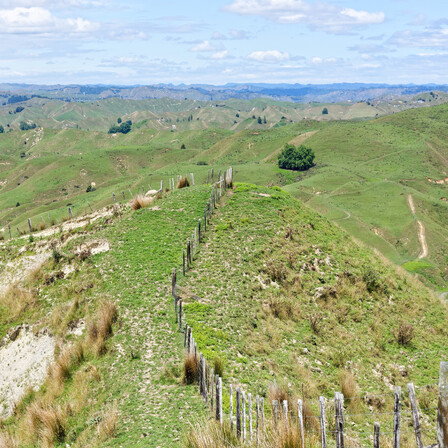
Targeted and efficient, Access Drone Spraying is the future of agricultural pest and weed control. Agvice’s drone spraying services offer precise application of herbicides, pesticides, and fertilisers, reducing waste and minimising environmental impact. Our drones can access difficult-to-reach areas, ensuring that every part of your farm is covered without disturbing the land or crop.
Aerial Mapping
Precision is key in modern agriculture, and Aerial Mapping using drone technology is a game-changer. AgVice’s drone-based aerial mapping services offer a more cost-effective alternative to traditional plane mapping, delivering high-resolution images and detailed land assessments without the high operational costs. Our drone technology provides accurate, time-efficient insights into crop health, soil conditions, and land use, helping you make informed decisions quickly and efficiently.

Eye in the Sky Consent
Obtaining Eye in the Sky Consent is crucial for operating drones within legal and ethical boundaries. At Agvice, we ensure that all drone operations are compliant with New Zealand’s Civil Aviation Authority (CAA) regulations and local council guidelines. Our team manages the entire consent process, from initial application to final approval, so you can focus on using the data to improve your farm’s performance.
Compliance Reporting
Environmental compliance is a critical aspect of agricultural operations, and drone technology plays a significant role in ensuring that your farm meets all necessary regulations. Agvice offers Compliance Reporting services that use drone-captured data to monitor and document your farm’s adherence to environmental standards. This includes reporting on effluent management, water usage, and soil health, providing you with accurate, up-to-date information for regulatory submissions.

Some of our Trusted Partners


Get in touch with us today to start optimising your farm with our advanced Drone Services
Carbon Advisory
Greenhouse Gas Omission Inventory (spp)
Environmental Planning
Integrated Farm Planning
Freshwater Farm Planning
Digital Storytelling
Communicate Key Information
Data-Driven Insights
GIS
Drone Services
Access Drone Spraying
Aerial Mapping
Eye in the Sky Consent
Compliance Reporting
Environmental Risk Management and Mitigation
Effluent Management Plans
Effluent Audits
Soil Remediation

